![]() Liptrap Grave
Liptrap Grave
 |
 |
Cut-off Date: 6 November 1998
Number of Burials: 1
Volunteers: Milton D. and Mary Lou Lake
Special Thanks: Morris D. Ververs, Mike
Schmeiser, Nancy Fischer
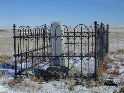
The Liptrap Grave is located just south of Simla, near the El Paso/Elbert county border. As you enter Simla from the west on U.S. Highway 24, turn south on Road 125 (or Washington Avenue), which is just west of the baseball field. Go two blocks and turn left on Summit Street. Follow the road for 1.4 miles. A gate at the end of the field on the south leads to the grave, which can be seen from the road. The grave is about a quarter of a mile from the road and is located on top of a knoll surrounded by farmland. According to GPS-derived geolocation (accurate to within 10 meters), the grave's coordinates are latitude 39°07'27.4"N and longitude 104°04'13.8"W. The marker is enclosed by a wrought-iron fence. Other Liptrap family members are buried in the Ramah Cemetery. According to owner Morris Ververs (P.O. Box 878, Westcliffe, CO 81252), Mrs. Liptrap walked the top of this knoll to watch for Indians. The marker reads:
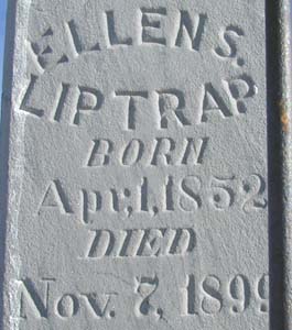
ELLEN S.
LIPTRAP
BORN
Apr, 1, 1852
DIED
Nov. 7, 1899
